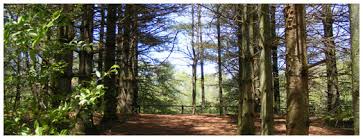
Hiking Trails Around Niagara Falls, Ontario, Canada from Explore-mag.com.
1. Niagara Recreation Trail, Canada
Distance: 15 miles out-and-back
Time: 1 – 2 hours per section
Difficulty: Moderate
Take the backroads away from the falls and bring the whole family with you. This long but leisurely paved path is divided into four sections, and each takes you through historical Ontario countryside.
How do I get to the trailhead?: Head north on Stanley Ave/Regional Rd 102 toward Spring St and turn right onto Bridge St. Turn left onto Victoria Ave and then left onto Niagara Pkwy.
Read more about this trail: niagarafallstourism.com
Distance from Niagara Falls: 3.5 miles
2. White Water Walk, Canada
Distance: 2.5 miles
Time: 1 – 2 hours
Difficulty: Easy
When the calm meets the storm: the White Water Walk is the tourist trail following the Great Gorge. Be prepared for a chilly breeze, whirlpool rapids, and watching gallons of water rushing to the trough.
How do I get to the trailhead?: Take the elevator down in downtown Niagara to the base of the gorge and take the tunnel that leads you to the boardwalk. Follow boardwalk to falls.
Read more about this trail: niagaraparks.com
Distance from Niagara Falls: 2.5 miles
3. Swayze Falls
Distance: 1/2 mile
Time: 30 minutes
Difficulty: Easy
Because it sometimes runs dry, this waterfall is best chased after a rainstorm. Spend the majority of the trail brushing through trees, over easy terrain and open clearings.
How do I get to the trailhead?: Follow RR 20 W and continue on ON 20 W. Turn right onto Merrittville Hwy and then left onto Holland Rd. Continue onto Roland Rd- entrance is on the right.
Read more about this trail: niagaragreenbelt.com
Distance from Niagara Falls: 13 miles
4. Devil’s Hole and Whirlpool Trail
Distance: 2.5 miles
Time: 1.5 hours
Difficulty: Moderate
Pack your passport, because this one is worth the cross-country border. Though classified as a “tourist” hike, it offers one of the most picturesque views of the falls.
How do I get to the trailhead?: Follow Stanley Ave and Rainbow Bridge to Rainbow Blvd in Niagara Falls (US). Take Main St to Niagara Scenic Pkwy and turn left.
Distance from Niagara Falls: 5.6 miles
5. Bruce Trail: Niagara Section
Distance: 41 miles point to point
Time: Varies
Difficulty: Moderate
Push through the urban sections before you make it to the tough stuff. The Bruce Trail has everything from wineries to historical landmarks to clear blue water. It’s the oldest and longest trail in Canada and great for a quick walk or a long trek.
How do I get to the trailhead?: Take Queen Elizabeth Way to Mountain Road. The trailhead is in the southeast corner of the large main parking lot.
Read more about this trail: niagaragreenbelt.com
Distance from Niagara Falls: 5 miles
6. Beamer Memorial Conservation Area Trail
Distance: 2.6 mile loop
Time: 1 – 2 hours
Difficulty: Moderate
This trail has character with its natural landscape and view of Lake Creek. You’ll catch some obstacles, including the tricky stairs, but be rewarded with views of waterfalls. In the spring, bring your binoculars and watch the annual hawk migration.
How do I get to the trailhead?: Take the QEW from Niagara Veterans Memorial Hwy W. Take Exit 71. Take Maple Ave and continue to Mountain St to Quarry Rd.
Read more about this trail: ontarioconservationareas.ca
Distance from Niagara Falls: 30 miles
7. DeCew Falls Loop
Distance: 1.6 mile loop
Time: 45 mins
Difficulty: Easy
A simple getaway from the falls without having to sacrifice rushing water. There are twowaterfalls on this one trail! Keep an eye out for the mill and be wary of the extremely steep gorge, especially if you’re hiking with children.
How do I get to the trailhead?: Take Niagara Veterans Memorial Hwy W. Drive to Decew Rd in St. Catherine’s. The destination will be on your right.
Read more about this trail: niagaragreenbelt.com
Distance from Niagara Falls: 11 miles
8. Ball’s Falls Historical Park Loop
Distance: 1/2 mile
Time: 1 hour
Difficulty: Easy
Two-thirds the height of Niagara, Ball’s Falls is not nearly as busy. This easy trail is very scenic and leaves you in an adorable historic village.
How do I get to the trailhead?: Take the QEW from Niagara Veterans Memorial Hwy and take exit 55. Take Jordan Rd, Haynes St and Glen Rd to Sixth Ave in Jordan and turn right.
Read more about this trail: npca.ca
Distance from Niagara Falls: 22 miles
9. Black Walnut Trail Loop
Distance: 2.7 mile loop
Time: 2 hours
Difficulty: Moderate
Known for its wildflowers and greenery, this hike is perfect for the avid birder. The trail winds through farmland and connects to Swayze Falls trail.
How do I get to the trailhead? Take Niagara Veterans Memorial Hwy to Pine St S in Thorold. Take the exit from On-58 N onto Pine Street and turn left. Turn right onto Decew Rd which becomes First Street, then turn left onto Pelham Rd.
Read more: friendsofshorthillspark.ca
Distance from Niagara Falls: 13 miles
10. Woodend Conservation Area
Distance: 2 mile loop
Time: 1 hour
Elevation Gain: 54 m
Difficulty: Easy
Perch yourself on a rock and snap a photo. This trail is ideal for hikers who love interesting formations. The hike offers a quick climb down the escarpment and is kid- and dog-friendly.
How do I get to the trailhead?: Take QEW and Mountain Rd 101 to your destination, turn right onto Taylor Rd and your destination will be on the right.
Read more about this trail: npca.ca
Distance from Niagara Falls: 7.5 miles


